|
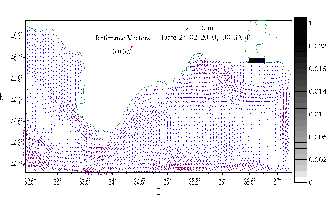
The hydrology forecasting is presented for the coastal area of the Black Sea, adjoining to the Crimean peninsula on the
basis of the regional high-resolution model SCOCREM (South Coast of Crimea Regional Model) integrated in the Black Sea Forecasting
Operational System (BSFOS).
The SCOCREM model is the version of POM model with
spatial resolution 1x1 km and 18 sigma layers in the vertical, and it is nested in the basin scale (5 km grid resolution) model
MHI with satellite altimetry data (provided by AVISO Center, France) and sea surface temperature (via direct reception of AVHRR)
data assimilation. The MHI model uses the atmosphere forcing obtained from ALADIN regional atmosphere forecasting (National
Meteorological Administration, Romania).
The simple model of impurity transport is embedded in the SCOCREM model to estimate the possible ways and area of
extending of oil spill from the Kerch Strait.
It is assumed, that an oil spot appears just from the Kerch Strait (shown by grey color) in the
beginning of forecast and its initial position is represented for the first forecasting term.
Output data carry preliminary character and can not be used like official materials of operative marine prognoses.
| 
