Federal State Budget Scientific Institution
Federal Research Center "Marine Hydrophysical Institute of RAS"
Remote Sensing Department
Head of Department
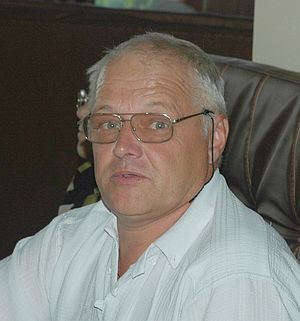
Sergey Stanichny
Current position
Head, Remote Sensing Department, Marine Hydrophysical Institute(MHI).
E-mail: sstanichny@mail.ru
Areas of expertise and skills
Remote Sensing and its applications, Radiation transfer, Satellite Data processing, Oceanography, projects development and management, professional training.
Employment
2005-present - Head of Department, MHI NASU, Remote Sensing Department
1994-2005 - Senior Scientist, MHI NASU, Remote Sensing Department
1989-1994 - Scientist, MHI NASU, Remote Sensing Department
1982-1989 - Junior Scientist, MHI NASU, Remote Sensing Department
1980-1982 - Engineer, MHI NASU., Remote Sensing Department
Education
1991 PhD (Physics/Mathematics) Marine Hydrophysical Institute, Sevastopol, U.S.S.R.
1980 MS (Physics) Moscow Institute of Physics and Technology, Moscow, U.S.S.R.
Membership
Honorary member of the Ukrainian Space Agency
Honorary collaborator of the Liege University
Main achivements
- More than 30 year experience and extensive track of records in Remote Sensing practical application and training;
- The Head of the Remote Sensing Department (RSD) of MHI NASU, the leading subdivision for Ocean Remote Sensing in the Eastern Europe for the last 8 years (http://dvs.net.ru/staff.shtml);
- Invited speaker for more than 20 conferences including several Assemblies of European Geosciences Union (EGU07, EGU10, etc);
- Invited lecturer for many higher education and training programs in Ukraine, Russia and Europe:
Moscow State University (Russia);
Liege University (Belgium);
Central European University (Hungary);
State Hydrometeorological University (Russia);
Far Eastern Federal University (Russia).
- Developed training materials in Remote Sensing and developed Software packages for National Space Agency and other professional institutions in Russia, Cyprus, Turkey;
- Development and successful scientific activities of the USSR-founded Remote Sensing Department under the lack of state support for science (in particular space) research in Ukraine; Successful fundraising efforts;
- Involvement, leadership and successful completion of numerous international projects;
- Fostering a number of researchers successfully working in international remote sensing agencies (e.g. at NASA, NATO, US EPA);
- MSc and PhD thesis supervision of international students: 16 MSc and 2 PHD successfully graduated students as a first supervisor and many as an adviser.
- Founding and maintaining the Marine Portal RSD (http://dvs.net.ru/mp) aimed at popularization of Remote Sensing and dissemination of the scientific findings and data. At the moment the portal has more than 310 registered users from 25 countries (guest login/password: sesame/sesame).
International projects
- FP 7 MyOcean, MyOcean2 (2009-2013);
- FP 6 ECOOP (2007-2010);
- FP 6 SESAME (2007-2010);
- INTAS Monitoring of Oil Pollution using Earth Observation Data: a multi-sensor, multi-platform approach (2007-2009); National Coordinator;
- NATO SfP Program project "Multi-disciplinary Analysis of the Caspian Sea Ecosystem" (2004-2007);
- EU 5 FP ARENA (2003-2005);
- EU 5 FP MFSTEP (2003-2005);
- CRDF project "Improved Methodology for Assessing the Impacts of the Aegean-Black Sea Exchange" (2002-2004);
- Inco-Copernicus Project "Desertification in the Aral Sea Region: A study of the Natural and Anthropogenic Impacts (Aral-Kum)",
NATO CLG Project "Climate Change in the Aral Region: Past Variability, Present Challenges, and Future Scenarios" (2001-2003);
- CRDF Project Monitoring of the Black Sea Mesoscale Circulation Based on Assimilation of Altimetry, Passive Microwaves/Scatterometer Wind Field and Imagery (1999-2001);
- Inco-Copernicus Project "Mixing and Distribution of the Physical and Biological INTAS Thematic Call with ESA 2006 Page 17 INTAS Ref. Nr 06-1000025-9091 Components of the Black Sea Ecosystem" (1997-1999);
- "Upwelling - Induced Primary Productivity in Coastal Waters of the Black Sea: Impact on Algorithms for Remote Sensing", sponsored by NASA (1995-1997).
Selected scientific results
- Operational Satellite Observing system for the Black Sea has been developed (http://dvs.net.ru/mp);
- Regional algorithms for satellite data processing for altimetry, optical and IR measurements has been created;
- The role of mesoscale processes and upwellings for the Black Sea ecosystem has been investigated;
- Several methods and algorithms to detect anomalous processes and pollution for marine environment have been built and applied for the Black, Caspian, Baltic and Aral seas;
- Software for satellite data processing for the needs of the Ukrainian Space Agency has been developed.
Publications
Full list of publications is available at Google Scholar profile
http://scholar.google.com/citations?user=2j7cUpwAAAAJ&hl=en
Selected publications
- G. Gawarkiewicz, G.Korotaev, S.Stanichny, D.Soloviev Synoptic upwelling and cross-shelf transport processes along the Crimean coast of the Black Sea. (1999). Cont. Shelf. Res. v.19, pp. 977-1005.
- Ginzburg, A. I., Kostianoy, A. G., Soloviev, D. M., Stanichny, S. V. (2000). Remotely sensed coastal/deepbasin water exchange processes in the Black Sea surface layer. Elsevier Oceanography Series, 63, 273-287.
- Anna I. Ginzburg, Andrey G. Kostianoy , Vladimir G. Krivosheya , Nikolay P. Nezlin, Dmitry M. Soloviev , Sergey V. Stanichny and Valeriy G. Yakubenko. (2002). Mesoscale eddies and related processes in the northeastern Black Sea. Journal of Marine Systems. 32 (1-3), pp. 71-90.
- Ginzburg, A. I., Kostianoy, A. G., Nezlin, N. P., Soloviev, D. M., Stanichny, S. V. (2002). Anticyclonic eddies in the northwestern Black Sea. Journal of Marine Systems, 32(1), 91-106.
- Andrei G. Zatsepin, Anna I. Ginzburg, Andrey G. Kostianoy, Vyacheslav V. Kremenetskiy, Vladimir G. Krivosheya, Sergey V. Stanichny, Pierre - Marie Poulain (2003). Observations of Black Sea Mesoscale Eddies and Associated Horizontal Mixing, JGR, 108, NO. C8, 3246, doi:10.1029/2002JC001390
- Peneva, E. L., Stanev, E. V., Stanichny, S. V., Salokhiddinov, A., Stulina, G. (2004). The recent evolution of the Aral Sea level and water properties: analysis of satellite, gauge and hydrometeorological data. Journal of marine systems, 47(1), 11-24.
- Kostianoy A.G., Lebedev S.A., Litovchenko K.Ts., Stanichny S.V., Pichuzhkina O.E Oil spill monitoring in the Southeastern Baltic Sea. (2005) Environmental Research, Engineering and Management. N3(33), P.73-79.
- S. Stanichny, V. Tigny, R. Stanichnaya, S. Djenidi (2005). Wind driven upwelling along the African coast of the Strait of Gibraltar. Geophysical Research Letters, VOL. 32, L04604, doi:10.1029/2004GL021760
- Kostianoy, A., Litovchenko, K., Lavrova, O., Mityagina, M., Bocharova, T., Lebedev, S., ... & Pichuzhkina, O. (2006). Operational satellite monitoring of oil spill pollution in the southeastern Baltic Sea: 18 months experience.Environmental research, engineering and management, 4(38), 70-77.
- G. Korotaev, E. Huot, F.-X. L. Dimet, I. Herlin, S. Stanichny, D. Solovyev, L. Wu. (2008). Retrieving Ocean Surface Current by 4-D Variational Assimilation of Sea Surface Temperature Images, in: Remote Sensing of Environment, Special issue on data assimilation, DOI: 10.1016/j.rse.2007.04.020, April 2008, vol. 112, p. 1464-1475.
- Oberhänsli, Hedi; Weise, Stephan M.; Stanichny Sergey. (2009) Oxygen and hydrogen isotopic water characteristics of the Aral Sea, Central Asia Journal of Marine Systems. v. 76, iss. 3, p. 310-321.
- Georgy I. Shapiro, Sergey V. Stanichny, Rimma R. Stanychna Anatomy of shelf-deep sea exchanges by a mesoscale eddy in the North West Black Sea as derived from remotely sensed data. (2010). in: Remote Sensing of Environment, Volume 114, Issue 4. doi:10.1016/j.rse.2009.11.020 Pp 867-875.
- Kubryakov, A. A., Stanichny, S. V. (2011). Mean Dynamic Topography of the Black Sea, computed from altimetry, drifter measurements and hydrology data. Ocean Science, 7(6), 745-753.
- Ilyin Yu. P. , Repetin L. N., Belokopytov V. N., Goryachkin Yu. N, Dyakov N. N., Kubryakov A. A., Stanichny S. V. Meteorological conditions of the seas of Ukraine - Volume 2: Black Sea, 2012 Publisher: ECOSY-Gidrofizika, Sevastopol, p. 421
- Kubryakov A. A., Stanichny S. V. Estimating the Quality of the Retrieval of the Surface Geostrophic Circulation of the Black Sea by Satellite Altimetry Data Based on Validation with Drifting Buoy Measurements Izvestiya, Atmospheric and Oceanic Physics, 2013, Vol. 49, No. 9, pp. 930-938.
Remote Sensing Department (together with LLC "DVS LTD")
Federal State Budget Scientific Institution Federal Research Center "Marine Hydrophysical Institute of RAS"
2, Kapitanskaya St., Sevastopol, 299011, Russian Federation
Phone: +7 (8692) 54-50-65
© 2002—2024
If you have a questions or comments about this site, please send mail to
webmaster
